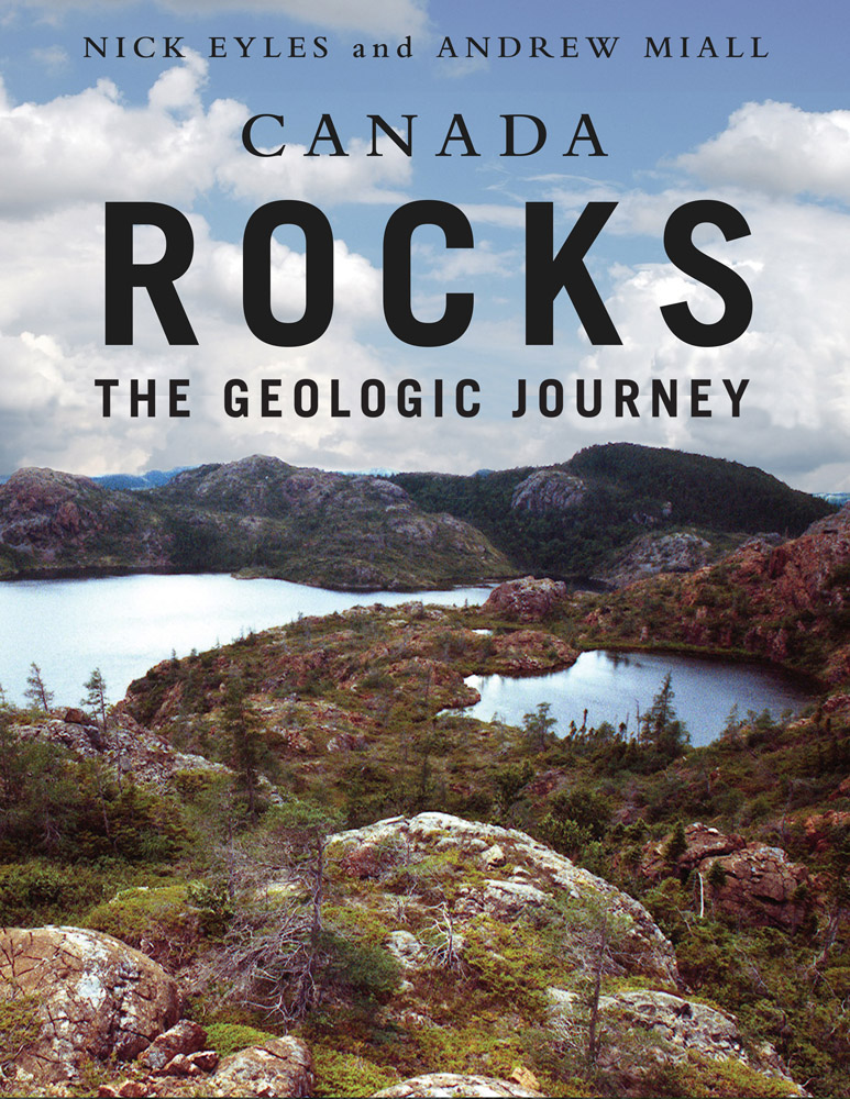
Canada Rocks
The Geologic Journey
Author Nick Eyles & Andrew Miall ISBN 9781550418606 Binding Trade Paper Publisher Fitzhenry & Whiteside Publication Date October 22, 2007 Size 216 x 279 mmOut Of Print
For anyone curious about the geological history of our country, Canada Rocks is a marvelous portrait of what the authors describe as the incredible 4 billion year 'construction project' that gave shape to the continents, mountains, and oceans of planet Earth, and created the world's second largest country - Canada.
Profusely illustrated throughout with full colour and black and white photographs, charts, maps, graphs and sketches, the book explores the country from north to south, and from east to west, exploring that incredible history through modern day sites and land shapes created in our distant past.
Read about:
- Rocks in Point Pleasant Park in Halifax were once part of Morocco, left behind when the Atlantic Ocean came into being.
- Canada's Arctic regions were formerly part of what today is Siberia. Greenland was once a part of Labrador.
- Fossils in a road cut in Cache Creek, British Columbia once lived in a sea that covered China.
- The violent collisions of continents and other land masses, the growth and decay of enormous mountain ranges, the impact of meteorites, and the comings and goings of vast ice sheets are explored in fascinating detail, as is the creation of our rocky resources from coal to diamonds.
An essential reference for students and anyone fascinated with the geological forces that created our country, the book includes a great many sites that can be visited for close-up study, making it an invaluable field guide for exploring our history and the world around us.
CONTENTS
INTRODUCTION ABOUT THE AUTHOR ACKNOWLEDGEMENTS CHAPTER 1: A HELLISH BEGINNING 1.1 The Hadean 1.2 The earliest continents: a watery birth 1.3 The birth of the Archean: a unique Canadian record 1.4 Early life on Earth CHAPTER 2: MOVING EARTH: PLATE TECTONICS 2.1 Looking deep into planet Earth 2.2 The formation and destruction of lithospheric plates 2.3 Volcanic activity and plate tectonics 2.4 Plate tectonics: is it the only model of how Earth works? 2.5 Paleomagnetism and moving plates 2.6 The rock cycle and sedimentary basins 2.7 A final comment on plate tectonics CHAPTER 3: THE UNITED PLATES OF CANADA: FOUR BILLION YEARS OF TECTONIC ACTIVITY 3.1 Construction and breakup: how continents evolve 3.2 The earliest continents 3.3 From Arctica to Nena to Rodinia 3.4 The beginning of the Paleozoic: the explosion of Rodinia 3.5 The assembly of Pangea 3.6 The breakup of Pangea and the westward drift of North America 3.7 The last few million years CHAPTER 4: CANADA'S HEARTLAND: THE SHIELD 4.1 A crustal collage built by plate tectonics 4.2 The North American craton vs. the Canadian Shield 4.3 History of the North American craton: a tale of four continents (Arctica, Nena, Columbia and Rodinia) 4.4 The first North American continent (c. 2.7 Ga): Arctica 4.5 The younger North American continents (c. 2.0 to 1.5 Ga): Nena and Columbia 4.6 The third North American continent (c. 1.7 to 1 Ga): part of Rodinia 4.7 The end of Rodinia (1 Ga to 600 Ma): Laurentia breaks free 4.8 Early life in Canada CHAPTER 5: GIANT SEAS COVER THE SHIELD: THE INTERIOR PLATFORM 5.1 The big picture 5.2 Earth processes that formed the sequences 5.3 The geography of giant seas 5.4 Devonian rocks 5.5 Pangea interval 5.6 Orogeny and transgression in the Cretaceous 5.7 Marking time: Global Standard Sections and Points CHAPTER 6: BUILDING EASTERN CANADA 6.1 Plate tectonics began here 6.2 Rodinia breaks up and the Iapetus Ocean is born 6.3 The Taconic orogeny and the closure of Iapetus 6.4 A glimpse of an ancient sea floor and the mantle below 6.5 The plate collision continues 6.6 Exotic fragments arrive from Europe and Africa 6.7 The final assembly of Pangea 6.8 Pangea breaks up and the Atlantic Ocean is born CHAPTER 7: BUILDING ARCTIC CANADA 7.1 Exploring by sea and by air 7.2 Tectonic setting 7.3 Early Paleozoic evolution of the Franklinian Basin and Pearya 7.4 Tectonism and sedimentation in the Siluro-Devonian: the end of the Franklinian Basin 7.5 The Sverdrup Basin 1: Upper Paleozoic 7.6 The Sverdrup Basin 2: The Mesozoic 7.7 The final phase: Greenland's brief life as a separate plate 7.8 The island topography evolve CHAPTER 8: BUILDING WESTERN CANADA 8.1 The big picture 8.2 Small bugs but big clues: signposts to Western Canada's origins 8.3 Pangea breaks up and western North America scoops up terranes 8.4 Anatomy and growth of the Canadian Cordillera 8.5 The importance of strike slip faulting 8.6 Volcanoes in western Canada: legacy of an active plate margin 8.7 The Rocky Mountains 8.8 The Western Canada Sedimentary Basin 8.9 The Rockies and the basin "north of 60" CHAPTER 9: WHEN THE ICE SHEETS CAME 9.1 Frozen history: Canada's glacial heritage 9.2 Continental ice sheets: the discovery of ice ages 9.3 Countdown to cold 9.4 Timesl(ice)s of the last (Laurentide) ice sheet 9.5 Canada's glacial landscapes CHAPTER 10: ROCKY RESOURCES: MINING IN CANADA 10.1 About 11,000 years ago: Canada's first mines 10.2 1000 A.D The Europeans arrive 10.3 Mid 1800's: The birth of the modern mining industry 10.4 Late 1800's: Railways and mining 10.5 Gold in Western Canada 10.6 Iron 10.7 Nickel 10.8 Diamonds: facets of a new industry 10.9 Mining ancient ocean floors: the importance of hydrothermal alteration 10.10 Skarn deposits 10.11 Deep weathering and mineral deposits in Canada 10.12 Uranium 10.13 Oil and gas 10.14 Coal 10.15 Potash and salt 10.16 Building with rock 10.17 The future CHAPTER 11: CHALLENGES FOR THE FUTURE 11.1 From geology to geoscience 11.2 Water wealth 11.3 The tectonic threat: earthquakes 11.4 Unstable slopes 11.5 Climate change 11.6 Geology and our health POSTSCRIPT: GEOLOGY AND THE BUILDING OF A CANADIAN IDENTITY ROCKTALES GLOSSARY SOURCE OF ILLUSTRATIONS INDEX1.1.1 The start of something Really Big 14 billion years ago
1.1.2 From dust to a planet2.1.1 Crust, mantle and core
2.1.2 The Earth stirs and our crust moves2.2.1 Where plates move away from each other: making oceanic crust
2.2.2 Where plates collide: the subduction factory
2.2.3 Where plates slide past each other: transform boundaries
2.2.4 Plate collisions and the building of continents2.3.1 Volcanoes at the edges of plates
2.3.2 Volcanoes in the middle of plates: hot spots
2.3.3 Under heat and pressure: metamorphic rocks2.4.1 LIPS and MOMO events
2.4.2 MOMO events and the history of life
2.4.3 Dynamic topography
2.4.4 Rock stars: the impact of meteorites4.1.1 Provinces and cratons
4.4.1 Formation of the Slave Province
4.4.2 Formation of the Superior Province; the largest piece of the craton
4.4.3 The Slave and Superior provinces weld together
4.4.4 Glaciation in the Huronian4.5.1 The Trans-Hudson, Thelon, Wopmay and Penokean orogenies
4.5.2 The Trans-Hudson Orogeny in eastern Canada
4.5.3 The Sudbury structure: A gigantic meteorite strike
4.5.4 Nena on the rack: The Midcontinent Rift4.6.1 The Grenville Province in central Canada
4.6.2 The Grenville Province in eastern Canada
4.6.3 Granites and moon rocks of the Grenville Orogen4.7.1 Disappearing mountains and the formation of the Canadian Shield
4.8.1 Eozoon canadense
4.8.2 Prokaryotes: the earliest bacteria
4.8.3 The Eukaryotes: building blocks of animals and plants
4.8.4 Life diversifies: the Cambrian explosion5.1.1 The platform
5.1.2 The sedimentary cover
5.1.3 The idea of "sequences"
5.1.4 Sequences in Canada5.2.1 The puzzles of epeirogeny and eustasy
5.2.2 Some events that plate tectonics cannot explain
5.2.3 Dynamic topography
5.2.4 Three surface processes driven by mantle heat
5.2.5 How the three processes explain the geology of Canada's interior platform5.3.1 Thinking about the Bahamas
5.3.2 Along the margins of the craton
5.3.3 The middle of the craton
5.3.4 Something different at Niagara5.4.1 Reefs and oil
5.4.2 Other Devonian rocks5.6.1 Unrest in the west
5.6.2 The highest seas of all time
5.6.3 The seas depart6.1.1 The puzzle of the trilobites
6.1.2 The modern era begins6.3.1 Animal life on the margins of Iapetus
6.4.1 Seeing the Moho
6.4.2 Pillows and smokers6.5.1 The end of the Taconic
6.6.1 The quest for Avalon: looking in Africa
6.6.2 Avalon arrives: the Acadian Orogeny
6.6.3 Meguma moves in6.7.1 Alleghanian squeezing
6.7.2 The Maritime Rift
6.7.3 In the end lies the beginning6.8.1 Foundering in Fundy
6.8.2 Hibernia reservoirs take shape7.2.1 The Canadian Shield
7.2.2 The Arctic platform
7.2.3 The Franklinian basin
7.2.4 Sverdrup basin
7.2.5 Arctic coastal plain8.1.1 Horses, helicopters and terranes
8.2.1 Wrangellia: a far travelled terrane
8.2.2 The Cordillera as collage of terranes8.4.1 Foreland Belt and Omineca Belt
8.4.2 Intermontane Belt
8.4.3 The Insular Belt and Coast Belt8.7.1 Up and down; but also sideways; the key to the Rocky Mountains
8.7 2 Mountains and Prairie are inextricably linked
8.7.3 The development of the fold-thrust belt8.8.1 Patterns of sedimentation
8.8.2 Cycles of sedimentation
8.8.3 The sculpting of the modern Foothills and Prairies8.9.1 The Beaufort-Mackenzie Basin
9.1.1 What is a glacier?
9.2.1 Louis Agassiz's 'great plough'
9.2.2 John William Dawson and icebergs
9.2.3 Joseph B. Tyrrell and the great Canadian ice sheet9.3.1 Plate tectonics and the start of global cooling (55 Ma)
9.3.2 The deep freeze comes to Canada (3 Ma): the first ice sheets
9.3.3 The deep sea record of ice ages: astronomical controls on climate9.4.1 The ice sheet begins to grow (110 ka)
9.4.2 The ice sheet reaches its maximum size (20 ka)
9.4.3 The ice sheet melts: our interglacial (the Holocene) begins (10 ka)
9.4.4 The answer to the climate puzzle may lie in space
9.4.5 The future?9.5.1 Canadian Shield
9.5.2 The plains of western and central Canada
9.5.3 The Cordillera
9.5.4 The offshore record10.3.1 Going underground: the first hard rock mines
10.4.1 Sudbury copper and nickel
10.4.2 Cobalt silver10.5.1 Placer gold
10.5.2 The 1858 gold rush and the Province of British Columbia
10.5.3 The 1896 gold rush in the Yukon Territory10.6.1 Iron Formations
10.6.2 Labrador: The iron centre of Canada
10.6.3 Bell Island, Newfoundland: mining ironstone under the ocean10.7.1 Voisey's Bay, Labrador
10.8.1 North America's first diamond (1843)
10.8.2 Recent discoveries10.9.1 Volcanogenic massive sulphides of the Archean
10.9.2 VMS deposits of the Ordovician Iapetus Ocean
10.9.3 Cretaceous VMS deposits of British Columbia
10.9.4 Hydrothermal lode gold
10.9.5 Water under the volcano: porphyry deposits10.13.1 The international oil industry begins (1858)
10.13.2 Mining for oil: Canada's Tar Sands industry
10.13.3 Natural gas
10.13.4 Gas hydrates; energy from ice 10.14.1 Coalbed methane
11.2.1 The urban threat to water
11.2.2 Waste and waters
11.2.3 Cleaning up our chemical mess
11.2.4 Case histories11.3.1 Seismic zones in Canada
11.4.1 Case histories
11.5.1 The climate-change debate
11.5.2 Living with changing climate: permafrost in Canada's far north
11.5.3 Canada's Arctic challenge
11.5.4 Ice shelf disintegration on Ellesmere Island: sign of a climatic criss?
11.5.5 Going to extremes: worse weather to come?
"Every page of the volume sparkles with information and entertainment. . . Just reading the captions in this profusely illustrated volume provides an education in the geological forces that have shaped our land for four billion years."
From "The Year's best Science books" - The Toronto Star
"The spectacular geological diversity that constitutes what we call Canada is captured in photography (some of it quite stunning), charts, maps and sketches. Meteorites, climate change, glaciers - they're all here, in layman's language."
-- The Globe and Mail
"What a labour of love is this meaty geologic journal of Canada. . . This weighty tome is a must-have reference text for anyone curious about the country's geological makeup. Of particular interest to Albertans is the book's no-nonsense treatment of mining and the oilsands resources of Western Canada."
-- Alberta Country Magazine
"Canada Rocks is a valuable reference work, illustrated with more than 500 maps, photos, and charts, and should be of use to the general reader for its clearly written explanations of why things are the way they are. . . For a better understanding of the country we live in, or of our own neighbourhoods, Canada Rocks is a valuable guide to the land around us, and to our own history."
-- The Chronicle-Journal (Thunder Bay, ON)
"This is a book that should be in every Canadian household. It presents the science of geology and the geology of Canada in a very colourful and easy to understand fashion, a feat never before accomplished. I have no doubt that any geologist who flips through the book will not be able to resist the urge to purchase it. It is the ideal source book for a basic understanding of the geology of every region of Canada and it may well inspire young people to pursue a career of studying Canadian rocks. We owe Eyles and Miall a debt of thanks for portraying our science and our rocks in such a fine fashion."
-- Reservoir the Canadian Society of Petroleum Geologists magazine
"Canada Rocks is at once a beautiful and well-illustrated coffeetable-quality paperback, and a dense and ponderous college-level text. Its attraction, however, is in the sheer range of its palette -- four billion years and counting."
-- The StarPhoenix, Saskatoon
"I really enjoyed this book. I caught up on topics that I have not thought about since my undergraduate degree, and I learned new things about climate and recent earthquakes. I enjoyed the sections on how geology and humans interact. Historical snapshots help bring the science alive. Almost everyone could find something to enjoy in this book, and it will give students and amateur geologists an important entry point into the fascinating story of Canada's past."
-- Arctic Magazine